Datei:Map of the Free State with districts labelled (2011).svg
Zur Navigation springen
Zur Suche springen

Größe der PNG-Vorschau dieser SVG-Datei: 716 × 599 Pixel. Weitere aus SVG automatisch erzeugte PNG-Grafiken in verschiedenen Auflösungen: 287 × 240 Pixel | 574 × 480 Pixel | 918 × 768 Pixel | 1.224 × 1.024 Pixel | 2.447 × 2.048 Pixel | 828 × 693 Pixel
Originaldatei (SVG-Datei, Basisgröße: 828 × 693 Pixel, Dateigröße: 503 KB)
![]()
Diese Datei und die Informationen unter dem roten Trennstrich werden aus dem zentralen Medienarchiv Wikimedia Commons eingebunden.
![]()
.svg?uselang=de)
Beschreibung
| Beschreibung |
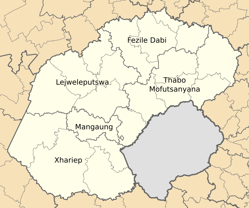
English: Map of municipal boundaries in the Free State, as they will be after the municipal elections of 18 May 2011, with district and metropolitan municipalities named. |
| Datum | |
| Quelle | Eigenes Werk |
| Urheber | Htonl |
Lizenz
Ich, der Urheberrechtsinhaber dieses Werkes, veröffentliche es hiermit unter der folgenden Lizenz:

|
Es ist erlaubt, die Datei unter den Bedingungen der GNU-Lizenz für freie Dokumentation, Version 1.2 oder einer späteren Version, veröffentlicht von der Free Software Foundation, zu kopieren, zu verbreiten und/oder zu modifizieren; es gibt keine unveränderlichen Abschnitte, keinen vorderen und keinen hinteren Umschlagtext.
Der vollständige Text der Lizenz ist im Kapitel GNU-Lizenz für freie Dokumentation verfügbar. |
This file is licensed under the Creative Commons Attribution-Share Alike 4.0 International, 3.0 Unported, 2.5 Generic, 2.0 Generic and 1.0 Generic license.
- Dieses Werk darf von dir
- verbreitet werden – vervielfältigt, verbreitet und öffentlich zugänglich gemacht werden
- neu zusammengestellt werden – abgewandelt und bearbeitet werden
- Zu den folgenden Bedingungen:
- Namensnennung – Du musst angemessene Urheber- und Rechteangaben machen, einen Link zur Lizenz beifügen und angeben, ob Änderungen vorgenommen wurden. Diese Angaben dürfen in jeder angemessenen Art und Weise gemacht werden, allerdings nicht so, dass der Eindruck entsteht, der Lizenzgeber unterstütze gerade dich oder deine Nutzung besonders.
- Weitergabe unter gleichen Bedingungen – Wenn du das Material wiedermischst, transformierst oder darauf aufbaust, musst du deine Beiträge unter der gleichen oder einer kompatiblen Lizenz wie das Original verbreiten.
Du darfst es unter einer der obigen Lizenzen deiner Wahl verwenden.
Dateiversionen
Klicke auf einen Zeitpunkt, um diese Version zu laden.
| Version vom | Vorschaubild | Maße | Benutzer | Kommentar | |
|---|---|---|---|---|---|
| aktuell | 02:04, 14. Mai 2011 | | 828 × 693 (503 KB) | Htonl | svg code tweak |
| 01:52, 14. Mai 2011 |  | 828 × 693 (503 KB) | Htonl | redo labels | |
| 21:08, 2. Mai 2011 |  | 828 × 693 (532 KB) | Htonl | spelling | |
| 20:56, 2. Mai 2011 |  | 828 × 693 (532 KB) | Htonl | == Summary == {{Information |Description ={{en|1=Map of municipal boundaries in the w:Free State, as they will be after the municipal elections of 18 May 2011, with district and metropolitan municipalit |
Dateiverwendung
Keine Seiten verwenden diese Datei.
Globale Dateiverwendung
Die nachfolgenden anderen Wikis verwenden diese Datei:
- Verwendung auf en.wikipedia.org
- Verwendung auf frr.wikipedia.org
- Verwendung auf hu.wikipedia.org
- Verwendung auf hy.wikipedia.org
- Verwendung auf ml.wikipedia.org
- Verwendung auf nso.wikipedia.org
- Verwendung auf pl.wikipedia.org
.svg)