Datei:"Map showing the path of the Cyclone, Wednesday, May 27, 1896." (superimposed on Map showing location of the Principal Residence Districts in St. Louis).jpg
Zur Navigation springen
Zur Suche springen

Größe dieser Vorschau: 800 × 542 Pixel. Weitere Auflösungen: 320 × 217 Pixel | 640 × 434 Pixel | 1.024 × 694 Pixel | 1.280 × 867 Pixel | 2.560 × 1.734 Pixel | 8.893 × 6.024 Pixel
Originaldatei (8.893 × 6.024 Pixel, Dateigröße: 16,28 MB, MIME-Typ: image/jpeg)
![]()
Diese Datei und die Informationen unter dem roten Trennstrich werden aus dem zentralen Medienarchiv Wikimedia Commons eingebunden.
![]()
.jpg?uselang=de)
Beschreibung
| Beschreibung |
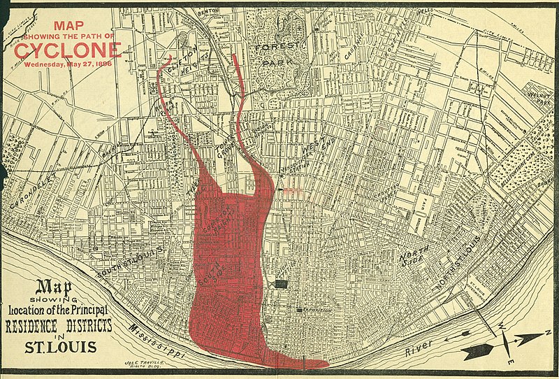
English: Title: "Map showing the path of the Cyclone, Wednesday, May 27, 1896." (superimposed on Map showing location of the Principal Residence Districts in St. Louis). In fact, it was the path of destruction of the 1896 St. Louis–East St. Louis tornado. |
| Datum | |
| Quelle |
Missouri History Museum URL: http://images.mohistory.org/image/41042947-97FC-B4C1-70AF-8BC4CAB1C292/original.jpg Gallery: http://collections.mohistory.org/resource/150639 |
| Urheber | after Jas. C. Travilla |
| Genehmigung (Weiternutzung dieser Datei) |
UND - Copyright undetermined |
| Identifier | N00883 |
| Part of | Disasters- Oversize Floods, Shipwrecks, and Tornados |
| Subjects | Disasters |
| Resource | 150639 |
| GUID | 41042947-97FC-B4C1-70AF-8BC4CAB1C292 |
Lizenz
|
Dies ist eine originalgetreue fotografische Reproduktion eines zweidimensionalen Kunstwerks. Das Kunstwerk an sich ist aus dem folgenden Grund gemeinfrei:
Nach offizieller Ansicht der Wikimedia Foundation sind originalgetreue Reproduktionen zweidimensionaler gemeinfreier Werke gemeinfrei. Diese fotografische Reproduktion wird daher auch als gemeinfrei in den Vereinigten Staaten angesehen. Die Verwendung dieser Werke kann in anderen Rechtssystemen verboten oder nur eingeschränkt erlaubt sein. Zu Details siehe Reuse of PD-Art photographs.
|
Dateiversionen
Klicke auf einen Zeitpunkt, um diese Version zu laden.
| Version vom | Vorschaubild | Maße | Benutzer | Kommentar | |
|---|---|---|---|---|---|
| aktuell | 17:32, 18. Aug. 2017 | | 8.893 × 6.024 (16,28 MB) | Fæ | Missouri History Museum. "Map showing the path of the Cyclone, Wednesday, May 27, 1896." (superimposed on Map showing location of the Principal Residence Districts in St. Louis). 1865to1899 #277.8 of 339 |
Dateiverwendung
Die folgende Seite verwendet diese Datei:
Globale Dateiverwendung
Die nachfolgenden anderen Wikis verwenden diese Datei:
- Verwendung auf en.wikipedia.org
.jpg)