Datei:Bonnet Carre Spillway aerial view northeast.jpg
Zur Navigation springen
Zur Suche springen

Größe dieser Vorschau: 750 × 600 Pixel. Weitere Auflösungen: 300 × 240 Pixel | 600 × 480 Pixel | 960 × 768 Pixel | 1.280 × 1.024 Pixel | 1.500 × 1.200 Pixel
Originaldatei (1.500 × 1.200 Pixel, Dateigröße: 703 KB, MIME-Typ: image/jpeg)
![]()
Diese Datei und die Informationen unter dem roten Trennstrich werden aus dem zentralen Medienarchiv Wikimedia Commons eingebunden.
![]()
| Beschreibung |
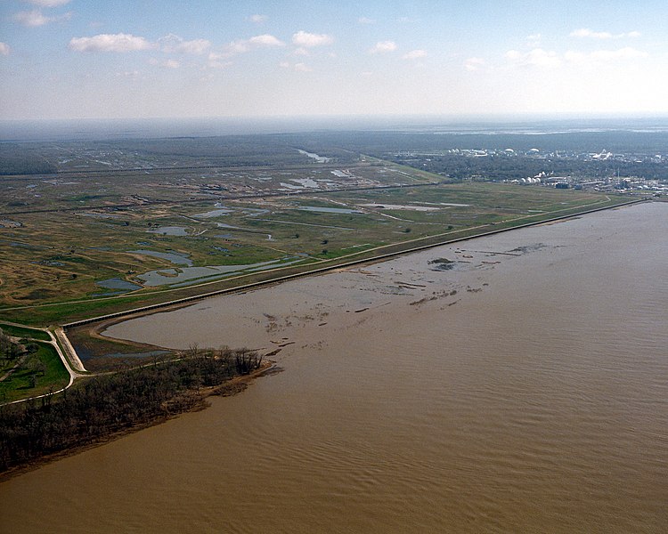
English: The opening of the Bonnet Carré Spillway on the Mississippi River. The spillway is designed to spill water from the river into Lake Pontchartrain during flooding of the river. The spillway is located about 12 miles (20km) west (upriver) of New Orleans, Louisiana, USA. View is to the northeast. Lake Pontchartrain can be seen in the far distance, about 5.5 miles (9 km) distant. |
|||
| Datum | ||||
| Quelle |
U.S. Army Corps of Engineers Digital Visual Library Image page Image description page Digital Visual Library home page |
|||
| Urheber | Michael Maples, U.S. Army Corps of Engineers | |||
| Genehmigung (Weiternutzung dieser Datei) |
|
|||
| Ort | Norco, Louisiana, USA |
| Kameraposition | | Dieses und weitere Bilder auf OpenStreetMap |
|---|
Dateiversionen
Klicke auf einen Zeitpunkt, um diese Version zu laden.
| Version vom | Vorschaubild | Maße | Benutzer | Kommentar | |
|---|---|---|---|---|---|
| aktuell | 06:17, 6. Apr. 2007 | | 1.500 × 1.200 (703 KB) | DanMS | {{Information | Description = {{en|The opening of the Bonnet Carré Spillway on the Mississippi River. The spillway is designed to spill water from the river into Lake Pontchartrain during flooding of the river. The spillway is located about 12 miles ( |
Dateiverwendung
Die folgende Seite verwendet diese Datei:
Globale Dateiverwendung
Die nachfolgenden anderen Wikis verwenden diese Datei:
- Verwendung auf en.wikipedia.org
- Verwendung auf fr.wikipedia.org