Datei:Location map municipal district Prague - Praha 2.PNG
Zur Navigation springen
Zur Suche springen
Es ist keine höhere Auflösung vorhanden.
Location_map_municipal_district_Prague_-_Praha_2.PNG (544 × 399 Pixel, Dateigröße: 14 KB, MIME-Typ: image/png)
![]()
Diese Datei und die Informationen unter dem roten Trennstrich werden aus dem zentralen Medienarchiv Wikimedia Commons eingebunden.
![]()
Beschreibung
| Beschreibung |
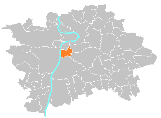
Čeština: Mapka umístění městské části Praha 2 English: Location map of municipal district Prague 2 |
| Quelle | self-made, based on image:Prague_municipal_districts.png |
| Urheber | Michiel1972 |
Lizenz
| Ich, der Urheberrechtsinhaber dieses Werkes, veröffentliche es als gemeinfrei. Dies gilt weltweit. In manchen Staaten könnte dies rechtlich nicht möglich sein. Sofern dies der Fall ist: Ich gewähre jedem das bedingungslose Recht, dieses Werk für jedweden Zweck zu nutzen, es sei denn, Bedingungen sind gesetzlich erforderlich. |
Dateiversionen
Klicke auf einen Zeitpunkt, um diese Version zu laden.
| Version vom | Vorschaubild | Maße | Benutzer | Kommentar | |
|---|---|---|---|---|---|
| aktuell | 10:37, 5. Sep. 2014 | | 544 × 399 (14 KB) | Valdemar | correction |
| 18:15, 4. Sep. 2014 |  | 544 × 399 (14 KB) | Valdemar | colors | |
| 21:47, 19. Sep. 2007 |  | 544 × 399 (17 KB) | Michiel1972 | {{Information |Description=Location map municipal district Prague |Source=self-made, based on image:Prague_municipal_districts.png |Date= |Author= Michiel1972 }} category:Maps of Prague |
Dateiverwendung
Die folgende Seite verwendet diese Datei:
Globale Dateiverwendung
Die nachfolgenden anderen Wikis verwenden diese Datei:
- Verwendung auf be.wikipedia.org
- Verwendung auf en.wikipedia.org
- Verwendung auf es.wikipedia.org
- Verwendung auf fa.wikipedia.org
- Verwendung auf it.wikipedia.org
- Verwendung auf mk.wikipedia.org
- Verwendung auf nl.wikipedia.org
- Verwendung auf pl.wikipedia.org
- Verwendung auf simple.wikipedia.org
- Verwendung auf sk.wikipedia.org
- Verwendung auf uk.wikipedia.org