Datei:Republican Party presidential primaries results by county, 2012 (corrected)-2.png
aus Wikipedia, der freien Enzyklopädie
Zur Navigation springen
Zur Suche springen

Größe dieser Vorschau: 800 × 424 Pixel. Weitere Auflösungen: 320 × 169 Pixel | 640 × 339 Pixel | 1.024 × 542 Pixel | 1.866 × 988 Pixel
Originaldatei (1.866 × 988 Pixel, Dateigröße: 226 KB, MIME-Typ: image/png)
![]()
Diese Datei und die Informationen unter dem roten Trennstrich werden aus dem zentralen Medienarchiv Wikimedia Commons eingebunden.
Beschreibung
| BeschreibungRepublican Party presidential primaries results by county, 2012 (corrected)-2.png |
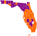
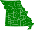
English: Map of the Republican Party (United States) presidential primaries, 2012 by county. |
||||||
| Datum | (UTC) | ||||||
| Quelle |
Diese Datei wurde von diesem Werk abgeleitet: Republican Party presidential primaries results by county, 2012 (corrected).png: |
||||||
| Urheber |
|
||||||
| Andere Versionen |
|
| Dieses Bild wurde digital nachbearbeitet. Das Originalbild kann hier eingesehen werden: Republican Party presidential primaries results by county, 2012 (corrected).png:
|
Lizenz
Ich, der Urheber dieses Werkes, veröffentliche es unter der folgenden Lizenz:
Diese Datei ist unter der Creative-Commons-Lizenz „Namensnennung – Weitergabe unter gleichen Bedingungen 3.0 nicht portiert“ lizenziert.
- Dieses Werk darf von dir
- verbreitet werden – vervielfältigt, verbreitet und öffentlich zugänglich gemacht werden
- neu zusammengestellt werden – abgewandelt und bearbeitet werden
- Zu den folgenden Bedingungen:
- Namensnennung – Du musst angemessene Urheber- und Rechteangaben machen, einen Link zur Lizenz beifügen und angeben, ob Änderungen vorgenommen wurden. Diese Angaben dürfen in jeder angemessenen Art und Weise gemacht werden, allerdings nicht so, dass der Eindruck entsteht, der Lizenzgeber unterstütze gerade dich oder deine Nutzung besonders.
- Weitergabe unter gleichen Bedingungen – Wenn du das Material wiedermischst, transformierst oder darauf aufbaust, musst du deine Beiträge unter der gleichen oder einer kompatiblen Lizenz wie das Original verbreiten.
Ursprüngliches Datei-Logbuch
This image is a derivative work of the following images:
- File:Republican_Party_presidential_primaries_results_by_county,_2012_(corrected).png licensed with Cc-by-sa-3.0
- 2012-03-25T03:53:24Z TL565 1866x988 (248347 Bytes) Paul actually won Maui County with provisional ballots.
- 2012-03-25T02:49:49Z EEL123 1866x988 (223653 Bytes) Updated Louisiana parishes
- 2012-03-25T02:26:06Z EEL123 1866x988 (221237 Bytes) Louisiana results
- 2012-03-25T01:23:47Z Metallurgist 1866x988 (158188 Bytes) Missouri caucus results
- 2012-03-21T20:29:27Z EEL123 1866x988 (220206 Bytes) Illinois update
- 2012-03-21T05:59:27Z EEL123 1866x988 (220223 Bytes) Illinois
- 2012-03-19T22:34:53Z Magog the Ogre 1866x988 (246666 Bytes) PR
- 2012-03-14T21:58:53Z Magog the Ogre 1866x988 (247637 Bytes) AS not broken down by region
- 2012-03-14T20:22:11Z EEL123 1866x988 (247716 Bytes) Updated a few coutines in Mississippi and Alabama
- 2012-03-14T13:57:15Z TL565 1866x988 (247315 Bytes) AS
- 2012-03-14T13:56:54Z TL565 1866x988 (247315 Bytes) AS
- 2012-03-14T08:58:17Z TL565 1866x988 (247443 Bytes) Add HI
- 2012-03-14T05:22:03Z Brianski 1866x988 (122369 Bytes) add Alabama, Mississippi
- 2012-03-11T05:26:00Z Gage 1866x988 (219219 Bytes) VIGOP.com lists Paul as winner of popular vote
- 2012-03-11T04:38:26Z Magog the Ogre 1866x988 (245925 Bytes) solid color, no borders for states/territories that don't break down their results by county
- 2012-03-11T03:06:44Z Creysmon07 1866x988 (252024 Bytes) Territories updated.
- 2012-03-10T23:45:08Z EEL123 1866x988 (251729 Bytes) Kansas counties updated
- 2012-03-09T04:09:36Z Gage 1866x988 (223962 Bytes) remove inaccurate ND counties
- 2012-03-07T17:15:04Z Masebrock 1866x988 (224787 Bytes) Kootenai ID
- 2012-03-07T17:11:22Z Masebrock 1866x988 (232833 Bytes) Kootenai ID
- 2012-03-07T07:58:01Z Masebrock 1866x988 (232833 Bytes) added ID except Kootenai, added ND based on overlaying the legislative districts results. It may not be 100% accurate, but this is the best available.
- 2012-03-07T05:41:33Z Masebrock 1866x988 (232008 Bytes) Fixed VT county, OK tie, TN and OH
- 2012-03-07T05:01:59Z Magog the Ogre 1866x988 (162883 Bytes) (forgot to save before upload)
- 2012-03-07T05:00:57Z Magog the Ogre 1866x988 (162879 Bytes) OK
- 2012-03-07T04:19:54Z Magog the Ogre 1866x988 (162220 Bytes) GA
- 2012-03-07T04:05:15Z Magog the Ogre 1866x988 (161717 Bytes) Reverted to version as of 03:40, 7 March 2012 - looks like several people have expressed reservations; self-revert (sort of); feel free to revert my revert.
- 2012-03-07T03:48:39Z Techman224 1866x988 (162263 Bytes) Please don't change without consensus
- 2012-03-07T03:40:30Z TL565 1866x988 (161717 Bytes) Reverted to version as of 03:35, 7 March 2012
- 2012-03-07T03:38:35Z Magog the Ogre 1866x988 (162263 Bytes) Reverted to version as of 03:34, 7 March 2012
- 2012-03-07T03:35:15Z TL565 1866x988 (161717 Bytes) Reverted to version as of 03:26, 7 March 2012
- 2012-03-07T03:34:30Z Magog the Ogre 1866x988 (162263 Bytes) Reverted to version as of 03:22, 7 March 2012
- 2012-03-07T03:26:50Z TL565 1866x988 (161717 Bytes) Reverted to version as of 02:52, 7 March 2012
- 2012-03-07T03:22:19Z Magog the Ogre 1866x988 (162263 Bytes) -VT, results are still coming in for too many precincts.
- 2012-03-07T03:15:53Z Magog the Ogre 1866x988 (162329 Bytes) color-blind friendly
- 2012-03-07T02:52:17Z Magog the Ogre 1866x988 (161717 Bytes) MA, VT
- 2012-03-07T02:49:22Z Magog the Ogre 1866x988 (161571 Bytes) VA
- 2012-03-07T02:43:11Z Magog the Ogre 1866x988 (160608 Bytes) add Northern Mariana Islands
- 2012-03-04T04:44:58Z EEL123 1866x988 (217185 Bytes) Washington counties updated
- 2012-03-01T03:32:19Z TL565 1866x988 (245564 Bytes) fix
- 2012-03-01T02:59:43Z Magog the Ogre 1866x988 (156091 Bytes) WY
- 2012-02-29T14:22:39Z TL565 1866x988 (245089 Bytes) fixed coloring
- 2012-02-29T11:37:08Z Interchange88 1866x988 (159133 Bytes) michigan, arizona added
- 2012-02-21T16:55:03Z Gage 1866x988 (155445 Bytes) Reverted to version as of 18:16, 20 February 2012
- 2012-02-21T07:35:51Z Info por favor 1862x982 (241321 Bytes) More color-deficient-vision accessible colors.
- 2012-02-21T07:33:17Z Info por favor 1866x988 (155445 Bytes) Reverted to version as of 18:16, 20 February 2012
- 2012-02-21T07:29:21Z Info por favor 1862x982 (241321 Bytes) == {{int:filedesc}} == {{Information |Description={{en|1=Map of the Republican Party (United States) presidential primaries, 2012 by county. {{legend|#8622ff|Counties won by Gingrich}} {{legend|#ffd943|Counties won by Paul}}
- 2012-02-20T18:16:27Z Magog the Ogre 1866x988 (155445 Bytes) ME
- 2012-02-20T01:46:53Z Magog the Ogre 1866x988 (155439 Bytes) Washington County, ME
- 2012-02-15T18:00:49Z OgreBot 1866x988 (155462 Bytes) (BOT): Uploading old version of file from en.wikipedia; originally uploaded on 2012-02-15 17:57:50 by [[:en:User:Magog the Ogre|Magog the Ogre]]
- 2012-02-13T04:15:39Z Magog the Ogre 1866x988 (161147 Bytes) ME
Hochgeladen mit derivativeFX
Kurzbeschreibungen
Ergänze eine einzeilige Erklärung, was diese Datei darstellt.
In dieser Datei abgebildete Objekte
Motiv
26. März 2012
Dateiversionen
Klicke auf einen Zeitpunkt, um diese Version zu laden.
| Version vom | Vorschaubild | Maße | Benutzer | Kommentar | |
|---|---|---|---|---|---|
| aktuell | 13:27, 26. Mär. 2012 |  | 1.866 × 988 (226 KB) | RoteDelano | == {{int:filedesc}} == {{Information |Description={{en|1=Map of the Republican Party (United States) presidential primaries, 2012 by county. {{legend|purple|Counties won by Gingrich}} {{legend|gold|Counties won by Paul}} {{legend|navy|Counties won by P... |
| 13:06, 26. Mär. 2012 |  | 1.866 × 988 (225 KB) | RoteDelano | == {{int:filedesc}} == {{Information |Description={{en|1=Map of the Republican Party (United States) presidential primaries, 2012 by county. {{legend|purple|Counties won by Gingrich}} {{legend|gold|Counties won by Paul}} {{legend|navy|Counties won by P... |
Dateiverwendung
Keine Seiten verwenden diese Datei.
Metadaten
Diese Datei enthält weitere Informationen (beispielsweise Exif-Metadaten), die in der Regel von der Digitalkamera oder dem verwendeten Scanner stammen. Durch nachträgliche Bearbeitung der Originaldatei können einige Details verändert worden sein.
| Horizontale Auflösung | 37,8 dpc |
|---|---|
| Vertikale Auflösung | 37,8 dpc |


