Datei:Seale A New and Correct Map of the Coast of Africa, from Cape Blanco, to the Coast of Angola 1750 UTA (A Map of the Gold Coast on a larger Scale).jpg

Originaldatei (2.416 × 1.292 Pixel, Dateigröße: 1,35 MB, MIME-Typ: image/jpeg)
![]()
Diese Datei und die Informationen unter dem roten Trennstrich werden aus dem zentralen Medienarchiv Wikimedia Commons eingebunden.
![]()
Beschreibung
| Titel |
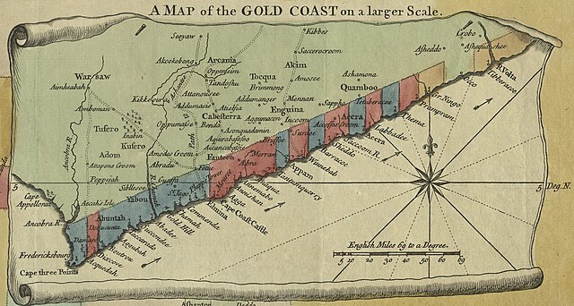
English: A Map of the Gold Coast on a larger Scale von English: A New & Correct Map of the Coast of Africa, from Cape Blanco, to the Coast of Angola: Exhibiting all the European Forts and Settlements |
||||||||||||||||||||||||||
| Datum | |||||||||||||||||||||||||||
| Quelle | UTA Libraries Cartographic Connections: Karte / Text | ||||||||||||||||||||||||||
| Urheber | |||||||||||||||||||||||||||
| Anerkennung |
English: UTA Libraries Special Collections, Gift of Dr. Jack Franke |
||||||||||||||||||||||||||
| Kartografische Angaben | |||||||||||||||||||||||||||
| Ortsbezug | Westafrika | ||||||||||||||||||||||||||
| Georeferenzierung | If inappropriate please set warp_status = skip to hide. | ||||||||||||||||||||||||||
| Bibliographische Angaben | |||||||||||||||||||||||||||
| Publikation |
Universal Magazine |
||||||||||||||||||||||||||
| Urheber |
bearbeitet von J. Hinton |
||||||||||||||||||||||||||
| Erscheinungsort | London | ||||||||||||||||||||||||||
| Archivalische Angaben | |||||||||||||||||||||||||||
| Sammlung |
|
||||||||||||||||||||||||||
| Technik | kolorierter Stich auf Papier | ||||||||||||||||||||||||||
| Andere Versionen | |||||||||||||||||||||||||||

.jpg?uselang=de)
Lizenz

|
This file was provided to Wikimedia Commons by the University of Texas at Arlington Libraries as part of a cooperation project. The University of Texas at Arlington Libraries is part of the University of Texas at Arlington, a public research university located in Arlington, Texas.
|
|
Der Urheber dieses Werks ist 1785 gestorben; es ist daher gemeinfrei, weil seine urheberrechtliche Schutzfrist abgelaufen ist. Dieses Werk ist gemeinfrei in den Vereinigten Staaten, weil es vor dem 1. Januar 1929 veröffentlicht (oder beim U.S. Copyright Office registriert) wurde. | |
| Es wurde festgestellt, dass diese Datei frei von bekannten Beschränkungen durch das Urheberrecht ist, alle verbundenen und verwandten Rechte eingeschlossen. | |
Dateiversionen
Klicke auf einen Zeitpunkt, um diese Version zu laden.
| Version vom | Vorschaubild | Maße | Benutzer | Kommentar | |
|---|---|---|---|---|---|
| aktuell | 22:33, 13. Jan. 2022 | | 2.416 × 1.292 (1,35 MB) | Michael Barera | File:Seale A New and Correct Map of the Coast of Africa, from Cape Blanco, to the Coast of Angola 1750 UTA.jpg cropped 45 % horizontally, 63 % vertically using CropTool with precise mode. |
Dateiverwendung
Die folgende Seite verwendet diese Datei:
Globale Dateiverwendung
Die nachfolgenden anderen Wikis verwenden diese Datei:
- Verwendung auf en.wikipedia.org
- Verwendung auf es.wikipedia.org
- Verwendung auf hu.wikipedia.org
- Verwendung auf ja.wikipedia.org
- Verwendung auf ru.wikipedia.org
- Verwendung auf simple.wikipedia.org
- Verwendung auf zh.wikipedia.org
.jpg)