Datei:Seattle - Portage Bay map.jpg
Zur Navigation springen
Zur Suche springen

Größe dieser Vorschau: 394 × 599 Pixel. Weitere Auflösungen: 158 × 240 Pixel | 316 × 480 Pixel | 663 × 1.008 Pixel
Originaldatei (663 × 1.008 Pixel, Dateigröße: 116 KB, MIME-Typ: image/jpeg)
![]()
Diese Datei und die Informationen unter dem roten Trennstrich werden aus dem zentralen Medienarchiv Wikimedia Commons eingebunden.
![]()
Beschreibung
| Beschreibung |
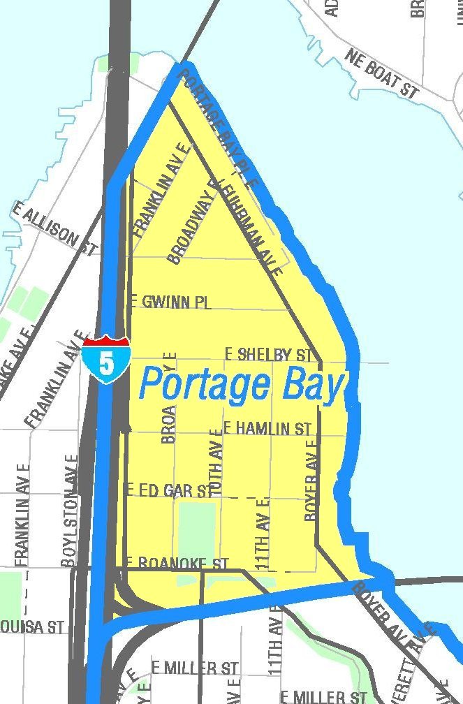
English: Map of Seattle's Portage Bay neighborhood. Like the other maps from the Seattle City Clerk's Neighborhood Map Atlas, this is not an official map; in particular, borders are not official.
|
|
| Datum | Retrieved from Seattle City Clerk's Neighborhood Map Atlas | |
| Quelle | Portage Bay, map NN-1213L from Seattle City Clerk's Neighborhood Map Atlas. | |
| Urheber | Office of the Seattle City Clerk | |
| Genehmigung (Weiternutzung dieser Datei) |
PD-Seattle-Neighborhood-Atlas. |
Lizenz
| This file is in the public domain because it is part of the Seattle Neighborhood Atlas, which the Seattle Clerk's Office has placed in the public domain.
While these maps are used by the clerk's office as a way to increase consistency in their own use of geographic names, the atlas is "not designed or intended as an 'official' City of Seattle neighborhood map, and has no official status." (See About Maps, Seattle Clerk's Office.) |

|
| This work has been released into the public domain by its copyright holder, Seattle Clerk's Office. This applies worldwide. In manchen Staaten könnte dies rechtlich nicht möglich sein. Sofern dies der Fall ist: Seattle Clerk's Office gewährt jedem das bedingungslose Recht, dieses Werk für jedweden Zweck zu nutzen, es sei denn, Bedingungen sind gesetzlich erforderlich.
|
Dateiversionen
Klicke auf einen Zeitpunkt, um diese Version zu laden.
| Version vom | Vorschaubild | Maße | Benutzer | Kommentar | |
|---|---|---|---|---|---|
| aktuell | 06:38, 28. Apr. 2011 | | 663 × 1.008 (116 KB) | Jmabel | == {{int:filedesc}} == {{Information |Description={{en|Map of Seattle's Portage Bay neighborhood. Like the other maps from the Seattle City Clerk's Neighborhood Map Atlas, this is ''not'' an official map; in particular, borders are not official.}} {{Seatt |
Dateiverwendung
Die folgende Seite verwendet diese Datei:
Globale Dateiverwendung
Die nachfolgenden anderen Wikis verwenden diese Datei:
- Verwendung auf en.wikipedia.org
- Verwendung auf es.wikipedia.org
- Verwendung auf fa.wikipedia.org