Datei:Canada Southern Ontario location map 2.png
Zur Navigation springen
Zur Suche springen

Größe dieser Vorschau: 800 × 577 Pixel. Weitere Auflösungen: 320 × 231 Pixel | 640 × 462 Pixel | 994 × 717 Pixel
Originaldatei (994 × 717 Pixel, Dateigröße: 296 KB, MIME-Typ: image/png)
![]()
Diese Datei und die Informationen unter dem roten Trennstrich werden aus dem zentralen Medienarchiv Wikimedia Commons eingebunden.
![]()
Beschreibung
| Beschreibung |
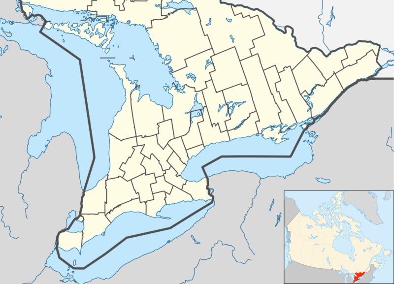
English: Location map of Southern Ontario, Canada.
Equirectangular projection, N/S stretching 155%. Geographic limits of the map:
Русский: Южная Онтарио
Українська: Південне Онтаріо |
| Datum | |
| Quelle | File:Canada Ontario location map 2.svg |
| Urheber | User:NordNordWest |
| Andere Versionen |
|


Lizenz
Ich, der Urheber dieses Werkes, veröffentliche es unter der folgenden Lizenz:
Diese Datei ist unter der Creative-Commons-Lizenz „Namensnennung – Weitergabe unter gleichen Bedingungen 3.0 nicht portiert“ lizenziert.
- Dieses Werk darf von dir
- verbreitet werden – vervielfältigt, verbreitet und öffentlich zugänglich gemacht werden
- neu zusammengestellt werden – abgewandelt und bearbeitet werden
- Zu den folgenden Bedingungen:
- Namensnennung – Du musst angemessene Urheber- und Rechteangaben machen, einen Link zur Lizenz beifügen und angeben, ob Änderungen vorgenommen wurden. Diese Angaben dürfen in jeder angemessenen Art und Weise gemacht werden, allerdings nicht so, dass der Eindruck entsteht, der Lizenzgeber unterstütze gerade dich oder deine Nutzung besonders.
- Weitergabe unter gleichen Bedingungen – Wenn du das Material wiedermischst, transformierst oder darauf aufbaust, musst du deine Beiträge unter der gleichen oder einer kompatiblen Lizenz wie das Original verbreiten.
Dateiversionen
Klicke auf einen Zeitpunkt, um diese Version zu laden.
| Version vom | Vorschaubild | Maße | Benutzer | Kommentar | |
|---|---|---|---|---|---|
| aktuell | 07:47, 20. Jul. 2012 | | 994 × 717 (296 KB) | 117Avenue | slight fix |
| 07:43, 20. Jul. 2012 |  | 994 × 717 (296 KB) | 117Avenue | {{Information |Description ={{en|1=Location map of Southern Ontario, Canada. Equirectangular projection, N/S stretching 155%. Geographic limits of the map: * N: 46.4° N * S: 41.4° N * W: 84.7° W * E: 74.0°... |
Dateiverwendung
Keine Seiten verwenden diese Datei.
Globale Dateiverwendung
Die nachfolgenden anderen Wikis verwenden diese Datei:
- Verwendung auf ar.wikipedia.org
- Verwendung auf azb.wikipedia.org
- Verwendung auf ban.wikipedia.org
- Verwendung auf bn.wikipedia.org
- Verwendung auf bs.wikipedia.org
- Verwendung auf ceb.wikipedia.org
- Verwendung auf ckb.wikipedia.org
- Verwendung auf cs.wikipedia.org
- Verwendung auf en.wikipedia.org
- Bay of Quinte
- Hamilton, Ontario
- Ottawa
- Windsor, Ontario
- Waterloo, Ontario
- Sarnia
- Perth, Ontario
- Kitchener, Ontario
- Kingston, Ontario
- Brampton
- Caledon, Ontario
- Prescott, Ontario
- Leamington, Ontario
- Cornwall, Ontario
- Guelph
- Aurora, Ontario
- Barrie
- Belleville, Ontario
- Brantford
- Brockville
- Burlington, Ontario
- Cambridge, Ontario
- Lindsay, Ontario
- Markham, Ontario
- Newmarket, Ontario
- Niagara Falls, Ontario
Weitere globale Verwendungen dieser Datei anschauen.