Liste der Landschaftsschutzgebiete im Kreis Düren
Zur Navigation springen
Zur Suche springen
Die Liste der Landschaftsschutzgebiete im Kreis Düren enthält die Landschaftsschutzgebiete des Kreises Düren in Nordrhein-Westfalen.
Liste
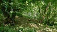
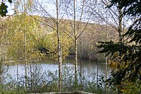
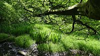
[Bearbeiten | Quelltext bearbeiten]| Bild | Nummer | Bezeichnung des Gebietes | Fläche in Hektar | WDPA-ID | Koordinaten | Datum der Verordnung |
|---|---|---|---|---|---|---|
| LSG-4903-0001 | LSG-Am Eselsberg | 7,68 | 555555316 | Position | 1984 | |
| LSG-4903-0002 | LSG-Fuchskaul-Heckental | 15,96 | 555555317 | Position | 1984 | |
 |
LSG-5003-0001 | LSG-Rurtal nördlich der Autobahn A 44 | 1493,64 | 555555418 | Position | 1984 |
| LSG-5003-0002 | LSG-Glimbacher Bruch, Ivenhainer Wald | 71,87 | 555555419 | Position | 1984 | |
| LSG-5003-0003 | LSG-Im Rurbruch | 146,86 | 555555420 | Position | 1984 | |
| LSG-5003-0004 | LSG-Tal des Kofferer Grabens | 74,70 | 555555421 | Position | 1984 | |
| LSG-5003-0005 | LSG-Rurtalhang zwischen Glimbach und Gevenich | 11,90 | 555555422 | Position | 1984 | |
 |
LSG-5003-0006 | LSG-Grosse Trisch, Schiffers Kamp, Kirchen Gerind | 57,37 | 555555423 | Position | 1984 |
 |
LSG-5003-0007 | LSG-Westlicher Steilhang des Rurtales | 17,51 | 555555424 | Position | 1984 |
| LSG-5003-0008 | LSG-Malefinkbachtal | 110,13 | 555555425 | Position | 1984 | |
| LSG-5003-0009 | LSG-Burg Tetz / Malefinkbachtal | 8,26 | 555555426 | Position | 1984 | |
 |
LSG-5003-0010 | LSG-Merzbachtal und Rurtalhang | 88,11 | 555555427 | Position | 1984 |
| LSG-5003-0011 | LSG-Saure Benden, Pferdskammer | 20,78 | 555555428 | Position | 1984 | |
| LSG-5003-0012 | LSG-Seitentaelchen bei Bourheim | 35,05 | 555555429 | Position | 1984 | |

|
LSG-5003-0013 | LSG-Im noerdlichen Teil des Kreises Dueren | 1978,52 | 555555430 | Position | 2007 |
 |
LSG-5004-0001 | LSG-Osthang des Rurtales zwischen Juelich und Broich | 74,05 | 555555433 | Position | 1984 |
 |
LSG-5004-0002 | LSG-Laubwald bei Haus Mariawald | 5,35 | 555555434 | Position | 1984 |
| LSG-5004-0003 | LSG-Rurtal südlich der Autobahn A 44 | 961,64 | 555555435 | Position | 1984 | |
 |
LSG-5004-0004 | LSG-Baggersee Juelich-Kirchberg mit Ruruferbereich | 30,92 | 555555436 | Position | 1984 |
| LSG-5004-0005 | LSG-Wymarshof | 17,21 | 555555437 | Position | 1984 | |
| LSG-5004-0006 | LSG-Ellebachtal Juelich-Stetternich-Hambach | 303,68 | 555555438 | Position | 1984 | |
| LSG-5004-0007 | LSG-Tagebaurestwaelder Stetternich-Hambach | 161,48 | 555555439 | Position | 1984 | |
| LSG-5004-0008 | LSG-Juelich-Sued, Stellwerk-Muehlenteich, Haus Koe | 27,50 | 555555440 | Position | 1984 | |
| LSG-5004-0009 | LSG-Hambach-Niederzier-Oberzier | 371,82 | 555555441 | Position | 1984 | |
 |
LSG-5004-0010 | LSG-Stetternicher Wald | 109,91 | 555555442 | Position | 1984 |
| LSG-5103-0003 | LSG-Im suedlichen Teil des Kreises Dueren | 2561,25 | 555558507 | Position | 2007 | |
| LSG-5104-0001 | LSG-Kirchberg | 5,91 | 555558521 | Position | 1984 | |
| LSG-5104-0002 | LSG-Lohberg-Kahlenberg und Seitentaelchen | 39,84 | 555558522 | Position | 1984 | |
| LSG-5104-0003 | LSG-Fuchstalhangwald mit Laubwald „Auf der Auel“ | 17,32 | 555558523 | Position | 1984 | |
| LSG-5104-0004 | LSG-Fuchstal-Indetal | 132,01 | 555558524 | Position | 1984 | |
| LSG-5104-0005 | LSG-Rurwiesen bei Altenburg und Schophoven | 151,76 | 555558525 | Position | 1984 | |
| LSG-5104-0006 | LSG-Polderflaechen zwischen Muehlenteich und Abwas | 24,28 | 555558526 | Position | 1984 | |
| LSG-5104-0007 | LSG-Rurwiesen zwischen Krauthausen und Merken | 60,01 | 555558527 | Position | 1984 | |
| LSG-5104-0008 | LSG-Rurwiesen und Auwaelder zwischen Merken u.Huch | 101,96 | 555558528 | Position | 1984 | |
| LSG-5104-0009 | LSG-Ellebachaue zwischen Oberzier und Ellen | 64,29 | 555558529 | Position | 1984 | |
| LSG-5104-0010 | LSG-Merzenicher Heide, Rather Feld und Grosse Bend | 312,69 | 555558530 | Position | 1984 | |
| LSG-5203-0001 | LSG-Oestlicher Huertgenwald | 2583,06 | 555558594 | Position | 2010 | |
| LSG-5204-0001 | LSG-Rurtalhaenge zwischen Untermaubach und Abenden | 1335,59 | 555558609 | Position | 2005 | |
| LSG-5204-0002 | LSG-Boerde bei Stockheim und Drove und Rurniederung zwischen Kreuzau und Niederau | 1144,06 | 555558610 | Position | 2005 | |
| LSG-5204-0003 | LSG-Voreifel zwischen Wollersheim und Bergheim | 2800,77 | 555558611 | Position | 2005 | |
| LSG-5204-0004 | LSG-Ruraue bei Kreuzau | 108,12 | 555558612 | Position | 2005 | |
| LSG-5204-0005 | LSG-Voreifel bei Gey | 322,95 | 555558613 | Position | 2010 | |
| LSG-5204-0006 | LSG-Gronauer Hecke | 92,12 | 555558614 | Position | 2010 | |
| LSG-5204-0007 | LSG-Rurtalhaenge | 570,43 | 555558615 | Position | 2010 | |
| LSG-5205-0001 | LSG-Stockheimer Wald-Drovetal-Stufenlaendchen-Eifelvorland | 1319,35 | 555558617 | Position | 1981 | |
| LSG-5205-0002 | LSG-Stueckchen | 15,37 | 555558618 | Position | 1981 | |
| LSG-5205-0003 | LSG-Vettweisser Busch | 28,83 | 555558619 | Position | 1981 | |
| LSG-5205-0004 | LSG-Luexheimer Aue | 1,99 | 555558620 | Position | 1981 | |
| LSG-5205-0005 | LSG-Neffelbachtal-Grosser Busch-Kirschenbusch | 511,89 | 555558621 | Position | 1981 | |
| LSG-5205-0006 | LSG-In der Baerenkaul | 3,18 | 555558622 | Position | 1981 | |
| LSG-5205-0007 | LSG-Dirlau | 8,59 | 555558623 | Position | 1981 | |
| LSG-5205-0008 | LSG-Im Waeldchen | 6,39 | 555558624 | Position | 1981 | |
| LSG-5205-0009 | LSG-Droverberg | 21,96 | 555558625 | Position | 1981 | |
| LSG-5205-0011 | LSG-Drovertalaue | 10,83 | 555558626 | Position | 1981 | |
| LSG-5205-0012 | LSG-Stockheimer Wald | 89,25 | 555558627 | Position | 1981 | |
| LSG-5205-0013 | LSG-Buschberg | 6,61 | 555558628 | Position | 1981 | |
| LSG-5205-0014 | LSG-Vettweisser Busch | 85,33 | 555558629 | Position | 1981 | |
| LSG-5205-0015 | LSG-Schafsmaar und Am Sterz | 29,13 | 555558630 | Position | 1981 | |
| LSG-5205-0016 | LSG-Luexheim | 3,74 | 555558631 | Position | 1981 | |
| LSG-5205-0017 | LSG-Neffelbachtal | 1,55 | 555558632 | Position | 1981 | |
| LSG-5205-0018 | LSG-Der grosse Busch | 11,85 | 555558633 | Position | 1981 | |
| LSG-5205-0019 | LSG-Ellebach | 1,27 | 555558634 | Position | 1981 | |
| LSG-5205-0020 | LSG-Am Rauhfuss | 24,27 | 555558635 | Position | 1981 | |
| LSG-5205-0021 | LSG-Im Stuettgen | 11,26 | 555558636 | Position | 1981 | |
| LSG-5206-0001 | LSG-Waeldchen am Galgenberg | 0,53 | 555558637 | Position | 1981 | |
| LSG-5206-0002 | LSG-Marienholz | 47,95 | 555558638 | Position | 1981 | |
| LSG-5206-0003 | LSG-Waeldchen am Sievernich – Roevenicher Weg | 2,15 | 555558639 | Position | 1981 | |
| LSG-5206-0004 | LSG-Wintermaar | 0,82 | 555558640 | Position | 1981 | |
| LSG-5206-0005 | LSG-Adelsbach | 1,95 | 555558641 | Position | 1981 | |
| LSG-5206-0006 | LSG-Ellenbusch | 0,65 | 555558642 | Position | 1981 | |
| LSG-5206-0007 | LSG-Regenbusch | 6,86 | 555558643 | Position | 1981 | |
| LSG-5206-0008 | LSG-Marienholz | 94,93 | 555558644 | Position | 1981 | |
| LSG-5303-0001 | LSG-Waelder der Kalltalhaenge | 809,38 | 555558681 | Position | 2010 | |
| LSG-5303-0002 | LSG-Hochflaeche im Bereich Raffelsbrand-Vossenack | 612,59 | 555558682 | Position | 2010 | |
| LSG-5303-0003 | LSG-Rote Kaul | 178,94 | 555558683 | Position | 2010 | |
| LSG-5304-0001 | LSG-Hochflaeche und Taeler bei Schmidt | 1243,43 | 555558711 | Position | 2005 | |
| LSG-5304-0002 | LSG-Terrassenlandschaft und Haenge zwischen Hausen und Heimbach | 331,60 | 555558712 | Position | 2010 | |
| LSG-5304-0003 | LSG-Rurtal und Seitenhaenge zwischen Blens und Hasenfeld | 602,12 | 555558713 | Position | 2010 | |
| LSG-5304-0004 | LSG-Hausener Busch/Hergartener Wald | 849,88 | 555558714 | Position | 2010 | |
 |
LSG-5304-0005 | LSG-Rurtalsperre | 331,61 | 555558715 | Position | 2010 |
| LSG-5304-0006 | LSG-Hochflaeche im Bereich Vossenack-Bergstein-Grosshau | 1533,57 | 555558716 | Position | 2010 | |
| LSG-5305-0001 | LSG-Thuir | 5,31 | 555558721 | Position | 1981 | |
| LSG-5305-0002 | LSG-Am Muldenauer Bach | 1,52 | 555558722 | Position | 1981 | |
| LSG-5305-0003 | LSG-Auf'm Reth | 9,06 | 555558723 | Position | 1981 | |
| LSG-5305-0004 | LSG-Boerde bei Embken und Wollersheim | 342,81 | 555558724 | Position | 2005 | |
| LSG-5305-0005 | LSG-Voreifel im Bereich Vladden-Hergarten-Duettling | 1074,16 | 555558725 | Position | 2010 | |
| LSG-5305-0006 | LSG-Vlattener Bach | 66,28 | 555558726 | Position | 2010 |
Siehe auch
[Bearbeiten | Quelltext bearbeiten]Weblinks
[Bearbeiten | Quelltext bearbeiten]Commons: Landschaftsschutzgebiete im Kreis Düren – Sammlung von Bildern, Videos und Audiodateien