Datei:West Midlands UK district map (blank).svg
Zur Navigation springen
Zur Suche springen

Größe der PNG-Vorschau dieser SVG-Datei: 800 × 547 Pixel. Weitere aus SVG automatisch erzeugte PNG-Grafiken in verschiedenen Auflösungen: 320 × 219 Pixel | 640 × 437 Pixel | 1.024 × 700 Pixel | 1.280 × 875 Pixel | 2.560 × 1.750 Pixel | 1.425 × 974 Pixel
Originaldatei (SVG-Datei, Basisgröße: 1.425 × 974 Pixel, Dateigröße: 720 KB)
![]()
Diese Datei und die Informationen unter dem roten Trennstrich werden aus dem zentralen Medienarchiv Wikimedia Commons eingebunden.
![]()
.svg?uselang=de)
| Beschreibung |
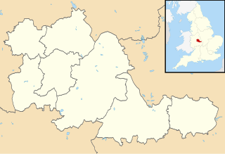
Map of the West Midlands, UK with districts shown. Equirectangular map projection on WGS 84 datum, with N/S stretched 160% Geographic limits:
|
| Datum | |
| Quelle | Ordnance Survey OpenData. Most data from Boundary-Line product. Lake data from Meridian 2 product. Inset derived from England location map.svg by Spischot. |
| Urheber | Nilfanion, created using Ordnance Survey data |
| Genehmigung (Weiternutzung dieser Datei) |
Diese Datei ist unter der Creative-Commons-Lizenz „Namensnennung – Weitergabe unter gleichen Bedingungen 3.0 nicht portiert“ lizenziert. Namensnennung: Contains Ordnance Survey data © Crown copyright and database right
|
| Bildnotizen | Diese Datei ist annotiert: Betrachte diese auf Commons. |
.svg)
Dateiversionen
Klicke auf einen Zeitpunkt, um diese Version zu laden.
| Version vom | Vorschaubild | Maße | Benutzer | Kommentar | |
|---|---|---|---|---|---|
| aktuell | 10:21, 22. Aug. 2010 | | 1.425 × 974 (720 KB) | Nilfanion | +inset, water colour tweak |
| 01:58, 17. Jul. 2010 |  | 1.425 × 974 (366 KB) | Nilfanion | {{Information |Description=Map of the West Midlands, UK with districts shown. Equirectangular map projection on WGS 84 datum, with N/S stretched 160% Geographic limits: *West: 2.22W *East: 1.40W *North: 52.68N *South: 52.33N |Source= |
Dateiverwendung
Die folgenden 15 Seiten verwenden diese Datei:
- Alexander Stadium
- Bescot Stadium
- Birmingham Airport
- Coventry Building Society Arena
- Meriden (West Midlands)
- Molineux Stadium
- New Cross Hospital
- Resorts World Arena
- SkyDome Arena
- St. Andrew’s Stadium
- Stourbridge
- The Hawthorns
- Utilita Arena Birmingham
- Villa Park
- Vorlage:Positionskarte England West Midlands
Globale Dateiverwendung
Die nachfolgenden anderen Wikis verwenden diese Datei:
- Verwendung auf ast.wikipedia.org
- Verwendung auf ca.wikipedia.org
- Verwendung auf en.wikipedia.org
- Verwendung auf es.wikipedia.org
.svg)