Datei:Bhutan location map.svg
Zur Navigation springen
Zur Suche springen

Größe der PNG-Vorschau dieser SVG-Datei: 800 × 522 Pixel. Weitere aus SVG automatisch erzeugte PNG-Grafiken in verschiedenen Auflösungen: 320 × 209 Pixel | 640 × 417 Pixel | 1.024 × 668 Pixel | 1.280 × 835 Pixel | 2.560 × 1.670 Pixel | 874 × 570 Pixel
Originaldatei (SVG-Datei, Basisgröße: 874 × 570 Pixel, Dateigröße: 124 KB)
![]()
Diese Datei und die Informationen unter dem roten Trennstrich werden aus dem zentralen Medienarchiv Wikimedia Commons eingebunden.
![]()
Beschreibung
| Beschreibung |
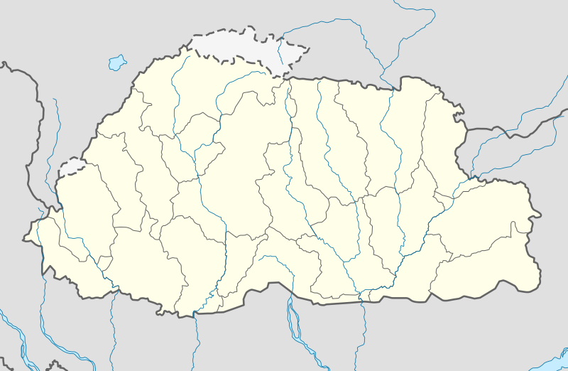
Deutsch: Positionskarte von Bhutan
Quadratische Plattkarte, N-S-Streckung 115 %. Geographische Begrenzung der Karte:
English: Location map of Bhutan
Equirectangular projection, N/S stretching 115 %. Geographic limits of the map:
|
| Datum | |
| Quelle | own work, using United States National Imagery and Mapping Agency data |
| Urheber | NordNordWest |
| Andere Versionen |
|


|
Diese Karte wurde in der Kartenwerkstatt erstellt oder verbessert. Auch du kannst dort Karten vorschlagen, die zu erstellen, verändern oder übersetzen sind.
|
Lizenz
Ich, der Urheberrechtsinhaber dieses Werkes, veröffentliche es hiermit unter der folgenden Lizenz:

|
Es ist erlaubt, die Datei unter den Bedingungen der GNU-Lizenz für freie Dokumentation, Version 1.2 oder einer späteren Version, veröffentlicht von der Free Software Foundation, zu kopieren, zu verbreiten und/oder zu modifizieren; es gibt keine unveränderlichen Abschnitte, keinen vorderen und keinen hinteren Umschlagtext.
Der vollständige Text der Lizenz ist im Kapitel GNU-Lizenz für freie Dokumentation verfügbar. |
Diese Datei ist unter der Creative-Commons-Lizenz „Namensnennung – Weitergabe unter gleichen Bedingungen 3.0 nicht portiert“ lizenziert.
- Dieses Werk darf von dir
- verbreitet werden – vervielfältigt, verbreitet und öffentlich zugänglich gemacht werden
- neu zusammengestellt werden – abgewandelt und bearbeitet werden
- Zu den folgenden Bedingungen:
- Namensnennung – Du musst angemessene Urheber- und Rechteangaben machen, einen Link zur Lizenz beifügen und angeben, ob Änderungen vorgenommen wurden. Diese Angaben dürfen in jeder angemessenen Art und Weise gemacht werden, allerdings nicht so, dass der Eindruck entsteht, der Lizenzgeber unterstütze gerade dich oder deine Nutzung besonders.
- Weitergabe unter gleichen Bedingungen – Wenn du das Material wiedermischst, transformierst oder darauf aufbaust, musst du deine Beiträge unter der gleichen oder einer kompatiblen Lizenz wie das Original verbreiten.
Du darfst es unter einer der obigen Lizenzen deiner Wahl verwenden.
Dateiversionen
Klicke auf einen Zeitpunkt, um diese Version zu laden.
| Version vom | Vorschaubild | Maße | Benutzer | Kommentar | |
|---|---|---|---|---|---|
| aktuell | 15:26, 24. Feb. 2022 | | 874 × 570 (124 KB) | NordNordWest | Reverted to version as of 04:11, 5 April 2021 (UTC) |
| 15:01, 24. Feb. 2022 |  | 874 × 570 (43 KB) | Turbo Slayer 2021 | Reverted to version as of 08:08, 15 September 2011 (UTC) | |
| 06:11, 5. Apr. 2021 |  | 874 × 570 (124 KB) | C1MM | Added rivers | |
| 21:07, 2. Dez. 2011 |  | 874 × 570 (51 KB) | NordNordWest | corr | |
| 17:28, 2. Dez. 2011 |  | 874 × 570 (48 KB) | NordNordWest | upd | |
| 10:08, 15. Sep. 2011 |  | 874 × 570 (43 KB) | NordNordWest | c | |
| 19:01, 14. Sep. 2011 |  | 874 × 570 (42 KB) | NordNordWest | c | |
| 20:08, 31. Jul. 2011 |  | 1.548 × 1.010 (133 KB) | JFHJr | {{Information |Description=Updates from the [http://www.election-bhutan.org.bt/index.php?option=com_content&id=132&Itemid=84 Bhutan Election and Demarcation Commissions] |Source=NordNordWest, Government of Bhutan |Date=2011 |Author=NordNordWest |P | |
| 10:22, 14. Okt. 2008 |  | 875 × 571 (109 KB) | NordNordWest | ||
| 10:16, 14. Okt. 2008 |  | 875 × 571 (108 KB) | NordNordWest | {{Information |Description= {{de|Positionskarte von Bhutan}} Quadratische Plattkarte, N-S-Streckung 115 %. Geographische Begrenzung der Karte: * N: 28.5° N * S: 26.4° N * W: 88.6° O * O: 92.3° O {{en|Location map of [[:en:Bhutan|Bhutan] |
Dateiverwendung
Die folgenden 34 Seiten verwenden diese Datei:
- Bhutan National League 2017
- Changlimithang Stadium
- Daga (Stadt)
- Damphu
- Drametse
- Flughafen Paro
- Flughafen Yongphulla
- Gedu
- Gelephu
- Jakar
- Kyichu Lhakhang
- Liste der Ramsar-Gebiete in Bhutan
- Lunana
- Mebisa
- Motithang
- Motithang Takin Preserve
- Nganglam
- Paro (Stadt)
- Phuentsholing
- Pinsoperi
- Punakha
- Punakha-Brücke
- Royal-Manas-Nationalpark
- Samdrup Jongkhar
- Sarpang
- Taktshang
- Thimphu
- Tongsa
- Wangchuck-Centennial-Nationalpark
- Wangdue Phodrang (Ortschaft)
- Wikipedia:Kartenwerkstatt/Archiv/2011-12
- Wikipedia:Kartenwerkstatt/Positionskarten/Asien
- Wikipedia Diskussion:WikiProjekt Georeferenzierung/Archiv/2011-IV
- Vorlage:Positionskarte Bhutan
Globale Dateiverwendung
Die nachfolgenden anderen Wikis verwenden diese Datei:
- Verwendung auf af.wikipedia.org
- Verwendung auf an.wikipedia.org
- Verwendung auf ar.wikipedia.org
- Verwendung auf ast.wikipedia.org
- Verwendung auf as.wikipedia.org
- Verwendung auf az.wikipedia.org
- Verwendung auf ba.wikipedia.org
- Verwendung auf be-tarask.wikipedia.org
- Verwendung auf be.wikipedia.org
- Verwendung auf bg.wikipedia.org
- Verwendung auf bn.wikipedia.org
Weitere globale Verwendungen dieser Datei anschauen.